UN
42 Foxcroft Road
£ 159,995
Description
We don't have a Description for this property.
- Bedrooms
- 2
- Bathrooms
- 0
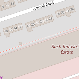


Leaflet © OpenStreetMap contributors
The heatmap indicates the level of crime in the area. The color of the heatmap indicates the crime severity and recency.
Metrics Year-on-Year
- Average area value
- 569,667.00 £Increased by 27.39 %
- Average area rental value
- 1,717.00 £/moIncreased by 40.16 %
- Est rental Yield
- 3.62 %Increased by 10.03 %
- Crime Rate
- 6.00 %Unchanged by 0.00 %
from 447,177.00 £
from 1,225.00 £/mo
from 3.29 %
from 6.00 %
Nearby Schools
| Name | Type | Ofsted | Distance |
|---|---|---|---|
| The Limes Nursery School | Local Authority Nursery School | Good | 0.41 KM |
| Whitehall Primary School | Community School | Outstanding | 0.41 KM |
| The Limes Nursery School & Children'S Centre | Children's Centre | 0.44 KM | |
| St Patrick'S Catholic Primary School | Academy Converter | Outstanding | 0.55 KM |
| Redfield Educate Together Primary Academy | Academy Sponsor Led | Good | 0.57 KM |
Images
Nearby Streets
| Name | Average Price | Average Sqft | Distance |
|---|---|---|---|
| Chalks Road | £ 325,000 | 0 | 0.00 KM |
| Barnes Street | £ 0 | 0 | 0.00 KM |
| George And Dragon Lane | £ 0 | 0 | 0.00 KM |
| Gordon Road | £ 380,000 | 0 | 0.00 KM |
| Ida Road | £ 250,000 | 0 | 0.00 KM |
Nearby Transport
| Name | NLC | TLC | Distance |
|---|---|---|---|
| Lawrence Hill | 3225 | LWH | 1.41 KM |
| Stapleton Road | 3250 | SRD | 1.64 KM |
| Bristol Temple Meads | 3231 | BRI | 3.51 KM |
| Montpelier | 3203 | MTP | 4.07 KM |
| Filton Abbey Wood | 3235 | FIT | 4.88 KM |
Nearby Listings
| Address | Price | Type | Score | Distance |
|---|---|---|---|---|
| St George, Bristol | £ 375,000 | BUY | 6 / 10 | 0.04 KM |
| Whitehall Road | Whitehall | £ 275,000 | BUY | Unknown | 0.10 KM |
| Oxenham Court, Bristol | £ 225,000 | BUY | 5 / 10 | 0.10 KM |
| Foxcroft Road, Bristol, BS5 | £ 285,000 | BUY | 5 / 10 | 0.12 KM |
| Charterhouse Yard, Bristol, BS5 | £ 425,000 | BUY | 6 / 10 | 0.13 KM |
Nearby Properties
| Address | Price | Distance |
|---|---|---|
| 42 Foxcroft Road | £ 159,995 | 0.00 KM |
| 2 Foxcroft Road | £ 238,000 | 0.00 KM |
| 36 Foxcroft Road | £ 120,000 | 0.00 KM |
| 16 Foxcroft Road | £ 142,280 | 0.00 KM |
| 29 Foxcroft Road | £ 258,000 | 0.04 KM |